
Trace Middletown Township Streets by Address
For a known physical address, use Bucks County assessment data before using the deed index. The free Board of Assessment iCare search can connect an address to its assessed owner, map or parcel number, municipality, situs address, and property or sales categories. That parcel number is the durable key for a Middletown Township street search. It travels more reliably between county systems than a postal label or a spelling variation in a street name.
Keep the search narrow. A parcel record identifies an assessed property interest, not every person associated with the address. The most useful result is a small record trail with the source and date preserved beside it. That makes it possible to revisit a record after the county updates its data or a deed clarifies an earlier result.
- Enter the house number and street in iCare Address Search. Record the assessed owner, parcel number, situs address, and municipality.
- Open the same parcel in the county map, select its polygon, and check that the municipal field says Middletown Township.
- Use the parcel number or physical address in the Tax Claim form only when its separate tax-record fields are needed.
- Search the assessed owner near the likely acquisition date in LANDEX as an Indirect Party, then examine the deed’s legal description and recital clause.
- For an older address clue, pair the deed trail with a dated directory, census, probate, or archive source rather than treating ownership as a household list.
Note: The Township check matters because lower Bucks postal labels can point to the same general area without naming the government that keeps the parcel record.
Middletown Township Street Directory Search Fields
The official iCare instructions describe Owner, Address, Parcel Number or ID, and Advanced Search routes. Address is the practical route for a street directory question. An asterisk can broaden a Number field or a Street field, and street-only searching can return assessed parcels along that street. Results are session-based and the portal displays 20 results per page, so save the parcel number rather than relying on a browser result list.
| iCare route | Field | How it works | Street-use caution |
|---|---|---|---|
| Address | Number | Optional text field; * can broaden it | Use an exact number first when one is known. |
| Address | Direction and Suffix | Optional live dropdowns | Use the current option list rather than guessing an abbreviation. |
| Address | Street | Core text field; * supports fragments | A street-only result is an assessed-parcel lead, not an occupancy roll. |
| Parcel Number or ID | Name | Unique map or parcel identifier; partial matching is documented | Best cross-office key once identified. |
| Advanced | Composite fields | Optional and subject to live changes | Confirm options in the portal before relying on them. |
A detail screen can include Profile, Sales, Permits, and Map categories, along with value components, land type, building structure, sketch, and an aerial parcel view. Multiple legal owners can appear on separate pages. These are property-record fields. They should be described as assessed information with the record date, not as a claim about present residents.
The official help page is also the source for the image below. It shows the documented search interface that starts the address-to-parcel portion of a Middletown Township street directory search.
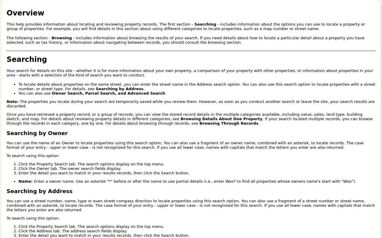
Use the returned map or parcel number to move forward. The map context is useful even when the street has a Langhorne or Levittown postal label.
Map Middletown Township Street Parcels
The county’s Maps & Data portal leads to the Parcel & Floodplain Viewer. Its address locator can center on an address candidate. Its Bucks County Parcels search accepts an exact PARCEL_NUM and can return up to six suggestions or results. After selecting a parcel, use browsing and zoom to inspect polygons that touch or lie near it. The published configuration did not confirm a public radius or buffer tool, so a visual map neighborhood is not a calculated distance search.
PARCEL_NUM | County parcel identifier used to join assessment, map, tax, and recorded-document research. |
|---|---|
ADDRESS | Parcel address field, useful for checking the selected polygon. |
MUNICIPALITY | Field that confirms Middletown Township jurisdiction. |
DEED_AREA | Published parcel attribute that may supply deed-area context. |
OWNER1 and OWNER2 | Assessed-owner fields, not a roster of people at the location. |
| Value and use fields | LAND_VALUE, BUILDING_VALUE, TOTAL_VALUE, LAND_USE_CODE, and MODIFY_DATE. |
County GIS is a reference map, not a survey or title determination. A selected polygon helps check parcel context and municipal jurisdiction, but a deed or survey controls when a legal boundary question matters.
Middletown Township Address and Tax Claim Fields
The county’s Tax Claim public inquiry is a supplementary address record, not a title or resident lookup. It expressly separates a parcel’s Location Address from Mailing Address, City, and Zip Code. A mailing value can be a correspondence destination for an owner, agent, or another recipient. It is not the same thing as the physical parcel location, and a claim result does not establish current title or that someone is present at that address.
| Form field | Entry rule | Meaning for address research |
|---|---|---|
| Parcel Number | Include every dash | Alternative identifier for the tax parcel. |
| Location Address | House number and street | Physical location field for a known parcel. |
| School District | Optional live dropdown | Use only the current form selection when needed. |
| Municipality | Optional live dropdown | Select Middletown Township to narrow the locality. |
| Name | Optional text | The form gives last-name-first or regular-name examples. |
| Mailing Address, City, Zip Code | Optional correspondence fields | Keep separate from the Location Address and parcel situs. |
The county’s public Tax Claim form is shown below. Its labeled mailing inputs make the separation between correspondence data and a physical location visible.
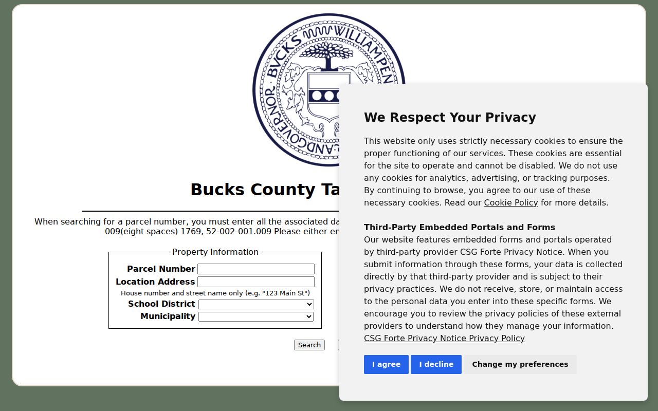
An empty claim result does not show that a parcel lacks an owner or occupant. Treat it as a limited tax-system result and verify a transaction through the Recorder when ownership timing matters.
Note: A physical address, an assessed-owner field, and a tax mailing field are three different facts that should never be silently merged.
Middletown Township Street Records Compared
Several record systems can be keyed to a Middletown Township address, but each answers a narrower question. Start with the address and parcel, then choose the next source for the specific property or historic question. The table separates what an address-indexed record can provide from what it cannot prove.
| Address record | Custodian | What it can contribute | Access path |
|---|---|---|---|
| Assessment iCare | Bucks County Board of Assessment Appeals | Assessed owner, parcel, situs, values, property and sales categories | Free online search; maintenance and updates can affect timing. |
| Parcel & Floodplain Viewer | Bucks County GIS | Selected polygon, address, municipality, assessed-owner and land-use fields | Free map browsing and exact parcel or address search. |
| Tax Claim inquiry | Bucks County Tax Claim | Claim, location, owner, and separate mailing fields | Public inquiry; it is not a complete title or occupancy record. |
| Recorded deed or plan | Bucks County Recorder of Deeds | Recorded parties, date, legal description, and predecessor references | Paid remote LANDEX route or the Recorder’s public research area. |
| Permit or code file | Middletown Township Building & Zoning | Defined address, project, inspection, or municipal-file context | Targeted request or counter channel; no historic public search was found. |
For older household history, a dated address-first volume can add a historic clue, but it should be checked in the original collection. The Directory Book has the historical holdings and reading methods, while the current street directory trail remains parcel-led.
Carry a Middletown Township Street to Deeds
LANDEX is a party-and-year deed index, not an address directory. The Recorder maintains records from 1684 to the present. Begin with an assessed owner and an approximate acquisition period, then search that person as an Indirect Party, the role used for a buyer or lender. Once the acquisition deed is found, the legal description and the recital or “being” clause can point to a prior book and page, instrument, or predecessor name.
Reverse the transaction carefully. A later seller or borrower is commonly searched as a Direct Party, while an earlier buyer is commonly searched as an Indirect Party. Historic indexes are organized in date bands rather than as one simple alphabetical list. New recordings from July 1, 2012 use an instrument number instead of a new book and page reference. Older records still use book and page, so a long chain can cross both systems.
- Parcel
- A county tax-map identifier for a defined property. It is the key that links current assessment and map research.
- Situs address
- The physical parcel location listed by a property system. It is distinct from a mailing address.
- Plat or recorded plan
- A recorded drawing or subdivision plan that can help identify lots and boundaries.
- Criss-cross directory
- An address-first directory that can provide a dated historical clue, not a current resident list.
Remote LANDEX access is paid. The Recorder’s public research area is a separate route for public research, and the county property-records page explains the counter and copy path. A recorded party and a deed date are stronger evidence than a name guessed from a street match.
Time Middletown Township Street Records
Record dates matter along a Middletown Township street. iCare publishes a weekly maintenance and update notice, so a newly recorded transfer may not appear in the assessment display at once. The Recorder’s holdings run from 1684 to the present, but older party indexes are divided into historic bands, including 1684–1919, 1920–41, 1942–51, and later periods through 1999–present. Search the band that fits the transaction instead of expecting one continuous modern index.
When a deed chain crosses July 1, 2012, change search methods with it. Newer recordings use an instrument number; earlier references commonly use book and page. A street directory result is most reliable when it preserves the assessment or map date, the document date, the party role, and the exact reference used to move to the next record.
Middletown Township Street Permit Context
Middletown Township Building & Zoning administers building, electrical, plumbing, zoning, subdivision and land-development work, along with inspections and code functions. The public permit instructions explain the local application path. The form can include a tax map number, construction-site address, subdivision or lot, work category, owner and applicant fields, contractor information, zoning details, and project description. That makes a defined permit file useful property context when a date and record type are known.
A permit application does not establish who later stayed at the property. No searchable historic public permit or code-case index was confirmed in this research. For a specific public record, send a narrowly described Right-to-Know request to the Township, rather than asking staff to build a street list. The Township’s contact point is 3 Municipal Way, Langhorne, PA 19047, 215-750-3800. Its form allows in-person, mail, or fax submission, and the Pennsylvania Right-to-Know Law normally calls for a response within five business days.
The Township permit guidance appears below. It supports a request for a specific address, project, or period, not a search for personal information.
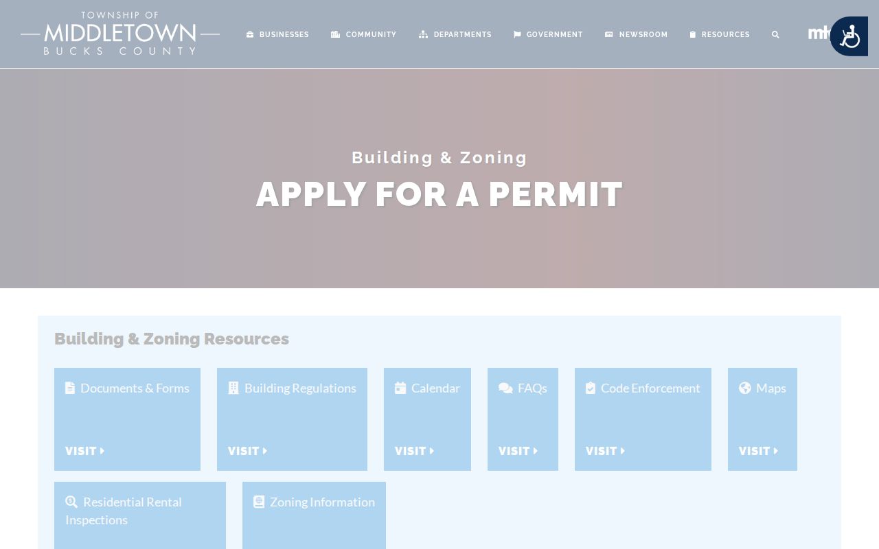
Preserve the request date and the Township’s response channel beside any released record. Local fee schedules and releasable content can change.
Middletown Township Street Labels and Jurisdiction
A Langhorne or Levittown label is not enough to select a records custodian. Middletown Township includes parts of those postal and development landscapes, while historic Langhorne, Langhorne Manor, Hulmeville, and Penndel separated from the older Township. For a current street directory search, use the parcel’s municipality field. For a historic address, combine the parcel, legal description, lot or development name, and the historic locality shown in the deed or dated source.
There is no verified universal street-renumbering converter, E911 historical-address converter, or single Township grid in the research. When an old street description does not match a modern address, the safer route is to follow the lot and legal description rather than force a modern street-name match. That approach also respects the distinction between a postal place name and a legal municipal boundary.
Note: A parcel number and recorded instrument reference are more stable cross-office identifiers than a postal city label.
Middletown Township Street Directory Limits
A street record can identify an assessed owner, a recorded party, a tax correspondence address, or a dated municipal file. It cannot establish every person connected to a household. Public property systems do not provide a general list of all occupants, utility customers, delivery recipients, DMV address holders, or people protected by the Address Confidentiality Program. The official Pennsylvania voter route is individual registration verification, not a public street browser.
Actual ACP addresses, applications, and waivers are confidential under 23 Pa.C.S. chapter 67. Never combine parcel, mailing, or map details to infer a protected address. Voter-list products also have certified-purpose restrictions and may not be posted online. If a record contains an error, ask the Board of Assessment, Township custodian, Recorder, or other office that keeps it to correct or explain the record.
Lawful personal use. Middletown Township street records are best used for a specific property, family-history, estate, or civic question. Do not use them to stalk, harass, or harm any person.